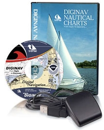
We received our GPS and DVD package from DIGINAV and
discovered that they did a nice job of collecting and bundling many useful
nautical items which are deemed public or shareware and placed them all
onto a DVD with a customized menu to access it all. Thus, making it easier for
you to use, and saving you time in having to manually search and find on the
internet and to download it all Individually. For a person who is new to boats
or sailing, having all these resources at your fingertips to help you learn to
navigate is a great idea. We were a bit disappointed that no Canadian
documents were included at this time.
A documented 10 step install process was included (on
paper), to ensure a flawless installation, just take the time to read and
follow it through. Overall basically we just found it a three part
installation process; GPS, Chat plotter software and Charts, and then onto
exploring the tutorials and videos.
Firstly you needed to install the GPS and drivers then load
up a small utility program that will auto-scan all your computers ports to
find and communicate to your GPS, it also displays all of the found satellites
flying overhead and displays each and their corresponding signal strengths. I
was surprised that the gps worked well even indoors, in the basement the GPS
picked up 8 satellites of which 6 were acceptable.
Secondly was the installation of SEACLEAR II to the
laptop to be able to save our tracking data. (It can also be run from
the DVD) and then the USA NOAA charts were installed. It is a bit of a lengthy
process which was overshadowed buy having a cup of coffee. When done, we
watched the Diginav's Tutorial Videos on how to use Seaclear. We then
loaded up Seaclear, clicked on "charts find boat", selected the
chart for our area, and we could now see our location via the gps right on the
middle of the chart. One feature I liked right away is that you can ZOOM in
and out to see the details on the charts without having to use your eyeglasses,
and you can use the full screen of the laptop to view the charts. As a comparison, I pulled out from my collection of paper charts the same chart #
and overall they both appeared to be the same.
Viewing all the included helpful resources (.pdf files) is
quite easy and there is a wealth of useful information, such as on how to read
and use the charts, how to navigate and placement of navigational aids and buoys,
dangers to be aware of, and much more. If there are no local sailing school or
sailing clubs close to your town to learn navigation tips from, then these are
quite import. Reading these may chew up a few evenings after supper while
having a cup of coffee, done best while outside the ground is still covered in
snow
Note: For marine safety, critical items always require a
backup, for example: electronic devices onboard are nice features to use until
they fail, having paper charts and a magnetic compass maybe a requirement of
your local USA/CAN Coast Guard or Policing agencies. Be prepaired and know what
you are required to have on onboard to fulfill an onboard inspection.